Posts

Showing posts from October, 2019

Mount Everest and Application of Theodolite on It
Image
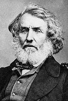
20/10/2019 Gargi Banerjee* Mount Everest (known in Nepali as Sagarmatha and in Tibetian Chomolungma; ‘Mother Goddess of the Land’), the World’s highest mountain above mean sea level, located in the Mahalangur Himal sub-range of the Himalayas. The international border between Nepal and China run across its summit point. Sir George Everest   Radhanath Sikdar Radhanath Sikdar was an Indian Bengali mathematician who is best known for calculating the height of the Mount Everest. He was born on October, 1813. When in 1831, Surveyor General of India Sir George Everest (with whose name the mountain has been named) was searching for a brilliant young mathematician with particular proficiency in spherical trigonometry Hindu College’s maths teacher Tytler recommended his pupil, 19 years old Radhanath. He joined the Geological Trigonometric Survey in 1831. He excelled in geodetic surveying. George Everest was impressed by his performance. He was
The Challenge Ahead

20/10/2019 Dhriti Banerjee*       "No challenge possess a great threat to future generations than climate change."                            - Barack Obama. People across the world are struggling with the everyday realities of climate change. The poor in developing countries are hit hardest and face difficult challenges. Climate change occurs when changes in Earth's climate system results in new weather patterns that last for at least a few decades to millions of years. The climate consists of 5 interacting parts: ~ • The atmosphere (air) • The hydrosphere (water) • The cryosphere (ice and permafrost) • The biosphere (living things) • The lithosphere (earth's crust and upper mantle) The climate system receives nearly all of its energy from the sun, with a relatively tiny amount from Earth's interior. The climate system also gives off energy to outer space. The balance of incoming and outgoing energy, and the passage of energy throug

Ichamati

Image
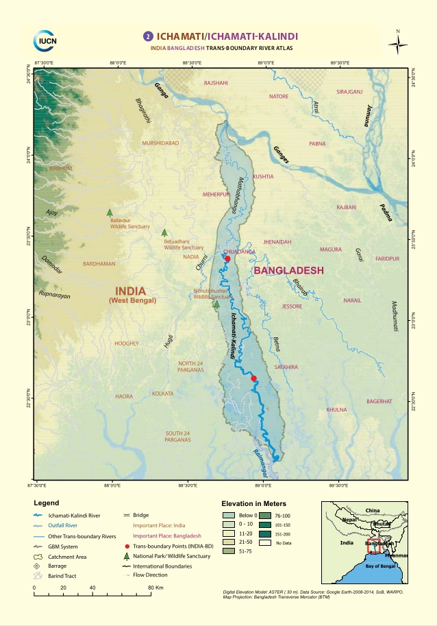
20/10/2019 Riya Das* Ichamati river is a trans boundary of two countries that is India and Bangladesh. It is also the boundary of these two countries. This river has few parts those are:           The longer part flows from the ‘Mathabhanga' river. This Mathabhanga river is the distributary of river ‘Padma’ . Then it flows 208 km and joins Kalindi in Hasnabad   in North 24 Parganas. In this Ichamati forms an ox bow lake.           Then it flows in the west of Dhaka and continues to be the   Ichamati of   Dinajpur. Ichamati river enters Bangladesh near Mubarakhpur. It flows for 35.5km in Bangladesh and again enters India as Duttaphulia in Nadia district. While the beds of Ichamati river is 4.3m higher than Mathabhanga and also Mathabhanga is higher than Churni about 15 cm. As a result no water enters Ichamati during dry season. Ichamati Problems : Siltation is the major problem of river due to manufacturing of guard walls for railway over bridge.